The Recorder's Office in Yavapai County, Arizona, digitizes deeds, subdivision maps, and land surveys dating back to 1864. Across cities and towns, municipal property records provide the tactical planning, zoning, and permitting that allow property to grow and evolve within the county's rural and urban landscape.
The Yavapai County real estate market shows a median home value of $302,900.00, while rents average $1,021.50. Families manage a household income of $57,841.50, and real estate taxes around 0.49% fund essential county services.
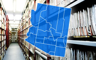
How to Search for Property Records in Yavapai County

In Yavapai County, AZ, individuals access real property records online, by mail, or in person.
Users can search the County Recorder’s Self-Service Online Search site to retrieve recorded documents, including deeds, liens, and land surveys.
For parcel-specific and spatial data, the County Assessor’s GIS Parcel Search tool allows lookups by parcel number or property address. It typically displays parcel boundaries, assessed values, and recent sales.
Mail requests are particularly useful for obtaining certified copies of legal instruments or verifying municipal records, such as zoning variances, floodplain designations, or building permit approvals. Meanwhile, in-person visits are often necessary for complex title research or for reviewing historical mining claims.
Documents recorded in the County Recorder’s Office before January 1, 2014, are indexed by book and page, while those after that date are searched using a reception or instrument number. This change in indexing systems requires searchers to navigate both methods when searching historical records.
To improve research efficiency and reduce the risk of overlooked property information, PropertyChecker can integrate book and page records with reception or instrument numbers into a single, unified search system. This enables users to locate and cross-reference documents across time periods without needing to adjust their search approach.
 Property Ownership and Title Information
Researchers can obtain property ownership and title information in Yavapai County through the Self-Service Online Search site, implemented by the County Recorder’s Office.
They can locate the most recent warranty deed, which allows them to verify current property ownership. Checking for encumbrances can also be done by inspecting deeds of trust, liens, or easements.
 Property Sales and Transaction History
To search and view property sales and transactions spatially, users can utilize the Yavapai County Assessor’s GIS Parcel Search tool. It includes a “recent sales” layer that overlays color-coded polygons on the map representing parcels sold within the last 5 years.
If a buyer wants to know if a house is in a floodplain and its sales history, the county GIS tool requires opening the interactive map, toggling layers to check flood zones, then going to a different screen for sales.
PropertyChecker enhances this data for more thorough due diligence and greater convenience. When applicable, the platform can show the sales history and environmental constraints simultaneously.
 Property Tax Assessment and Payment Records
The Real Property Appraisal Division of the Yavapai County Assessor’s Office determines the full cash value (market value) and the limited property value (taxable value) of properties in the county. To assist citizens in meeting tax obligations, the Yavapai County Treasurer’s Office bills and collects real property taxes.
Citizens and professionals can track a property’s valuation history using the GIS Parcel Search tool provided by the County Assessor’s Office. For tax bills, exemptions, payment histories, and delinquent taxes, they can access such records through the Yavapai County Treasurer's Parcel Information system.
If a property owner believes their property’s full cash value is incorrect, they can file a “Petition for Review of Real Property Valuation” (DOR Form 82130R) with the County Assessor’s Office.
 Property Characteristics and Parcel Details
The GIS Parcel Search tool hosted on the Yavapai County Assessor’s official website offers a deep dive into parcel data. This interactive map application can pull up property characteristics, such as total acres, gross living area, building type, year built, and bedroom/bathroom counts.
At the top-right corner of the tool, users can use the search bar to enter the owner’s name, property address, subdivision, or parcel number.
 Zoning, Land Use, and Planning Records
The Planning Unit of the Yavapai County Development Services Department maintains records related to comprehensive planning, planning and zoning cases, and rezoning actions. In coordination with this division, the Land Use Unit oversees enforcement and compliance files associated with the Yavapai County Planning and Zoning Ordinance.
Users can download the Setbacks and Density Chart, which presents zoning information, including required setbacks, minimum lot sizes, permitted building heights, and yard requirements. However, these records apply only to properties located in the county’s unincorporated areas.
 Legal Documents Affecting Property
Legal documents impacting real properties across Yavapai County are available digitally through the County Recorder’s Self-Service Online Search site.
The website provides a general index of documents, including deeds, deeds of trust, and liens. It also offers specialized indexes for subdivision maps, land surveys, and mining documents, as well as a historical deed index. These records date back to 1864.
Depending on the index being used, individuals can search for documents by grantor or grantee name, reception number, book and page, or town-section-range.
 Building Permits, Inspections, and Construction Records
The Yavapai County Development Services Department’s Building Safety Unit ensures that construction in unincorporated areas complies with applicable building codes. On the permitting aspect, the Customer Service and Permitting Unit manages the intake, processing, and issuance of permits.
These units use the CitizenServe Online Permitting Portal, where individuals can access permit records, plan sets, inspection checklists, and geotechnical reports.
 Maps and Visual Property Data
Through the GIS Parcel Search tool, researchers can view, search, and analyze over 186,000 property parcels across Yavapai County’s approximately 8,123-square-mile land. They can use the mapping app’s zoom tools to view parcel boundaries, lot dimensions, subdivision boundaries, and building footprints.
For developers, GIS professionals, or advanced users, the Yavapai County GIS Department provides downloadable raw spatial data via the Yavapai County GIS Open Data Site.
How to Do a Yavapai County Parcel Search
A Yavapai County parcel search can be conducted through two available tools. The first is the Yavapai County Interactive Map, the County Assessor’s GIS Parcel Search tool. The map includes a Property Search panel on the right side, along with Parcel History search options and a Location Search tool for additional lookup methods.
The second tool is the Yavapai County Parcel Search, accessible directly at gis.yavapaiaz.gov/v4/search.aspx. The Property Search bar at the top accepts an address, parcel number, owner name, or subdivision name.
A Focused Search section below provides five dedicated tabs: Parcel Number, Address Search, Owner Search, Subdivision Search, and Parcel History Search. The Parcel Number tab includes separate fields for Book, Map, and Parcel. Other tabs have their respective input fields tailored to each search type.
Yavapai County Property Statistics
Displayed here are charts summarizing the county's tax rates, accompanied by insights into median home values, income figures, and rent rates.
Median Rent
| Arizona |
$890.00
|
| National |
$840.25
|
-
+14.8 %vs Arizona
-
+21.6 %vs National
Median Home Value
| Arizona |
$176,850.00
|
| National |
$173,750.00
|
-
+71.3 %vs Arizona
-
+74.3 %vs National
Median Household Income
| Arizona |
$56,902.00
|
| National |
$65,108.00
|
-
+1.7 %vs Arizona
-
--11.2 %vs National
Median Property Tax Rate
| Arizona |
0.56%
|
| National |
0.74%
|
-
-12.5%vs Arizona
-
-33.8 %vs National
Unemployment Rate
| Arizona |
3.44%
|
| National |
2.87%
|
-
-36.3 %vs Arizona
-
-23.7 %vs National
Renter Occupied Housing
| Arizona |
22.77%
|
| National |
21.81%
|
-
+11.9 %vs Arizona
-
+16.9 %vs National
Yavapai County Registrar of Deeds
Acting as the official registrar of deeds, the Yavapai County Recorder’s Office maintains all documents that establish the chain of title and legal ownership of real property within the county.
Deeds, liens, mortgages, notices of trustees’ sale, releases, subdivision maps, plats, and affidavits of property value are some common examples of such documents.
The Yavapai County Treasurer’s Office often relies on notices of trustees' sale to update property tax records when ownership changes after foreclosure. It reviews these documents to identify new owners, adjust billing accounts, and ensure accurate tax collection.
The County Recorder’s Office uses the Self-Service Online Search site for users to locate, print, and order copies of documents online.
For certified copies, individuals may send a written request or a completed Official Copy Request Form by mail, along with the payment and a self-addressed stamped envelope.
The fee for document copies is $1 per page, with a $3 certification fee.
Public computers are also available at the Prescott and Cottonwood offices for in-person research.
Municipality-Level Property Records Information
In Yavapai County, independent cities and towns maintain supplemental property records that govern land use, development, and municipal services.
Suppose a Sedona property owner wants to build in a location where steep slopes restrict the building envelope. They must submit a request to the City of Sedona Board of Adjustment to obtain a variance to the city’s zoning code, and the decision is recorded in the city’s land-use database.
While the County Recorder’s Office and Assessor’s Office serve as the central hubs for ownership, tax, and parcel information, these 10 incorporated cities and towns manage the immediate development and historical aspects of a property.
County Offices That Maintain Yavapai County Property Records
Researchers in Yavapai County need to engage with these specific county offices to secure critical property records, including ownership and appraisal data, tax histories, land-use and countywide planning documents, and GIS maps:
Yavapai County Assessor’s Office - Real Property Appraisal Division
- 1015 Fair St., 1st Floor, Prescott, AZ 86305-1852
- (928) 771-3220
- (928) 771-3181
- web.assessor@yavapaiaz.gov
Yavapai County Recorder’s Office
- 1015 Fair St., Room 228, Prescott, AZ 86305
- (928) 771-3244 (Select Option 6)
- recorder@yavapaiaz.gov
Yavapai County Treasurer's Office
- 1015 Fair St., 2nd Floor, Prescott, AZ 86305
- (928) 771-3233
- web.treasurer@yavapaiaz.gov
Yavapai County Development Services Department - Planning Unit
- 1120 Commerce Dr., Prescott, AZ 86305
- (928) 771-3214 (Request Line)
- planning@yavapaiaz.gov
Yavapai County Development Services Department - Land Use Unit
- 1120 Commerce Dr., Prescott, AZ 86305
- (928) 771-3214 (Request Line)
- web.development.services@yavapaiaz.gov
Yavapai County Development Services Department - Building Safety Unit
- 1120 Commerce Dr., Prescott, AZ 86305
- (928) 771-3214 (Request Line)
- web.development.services@yavapaiaz.gov
Yavapai County GIS Department
- 1120 Commerce Dr., Prescott, AZ 86305
- (928) 771-3169
- yavgis@yavapaiaz.gov